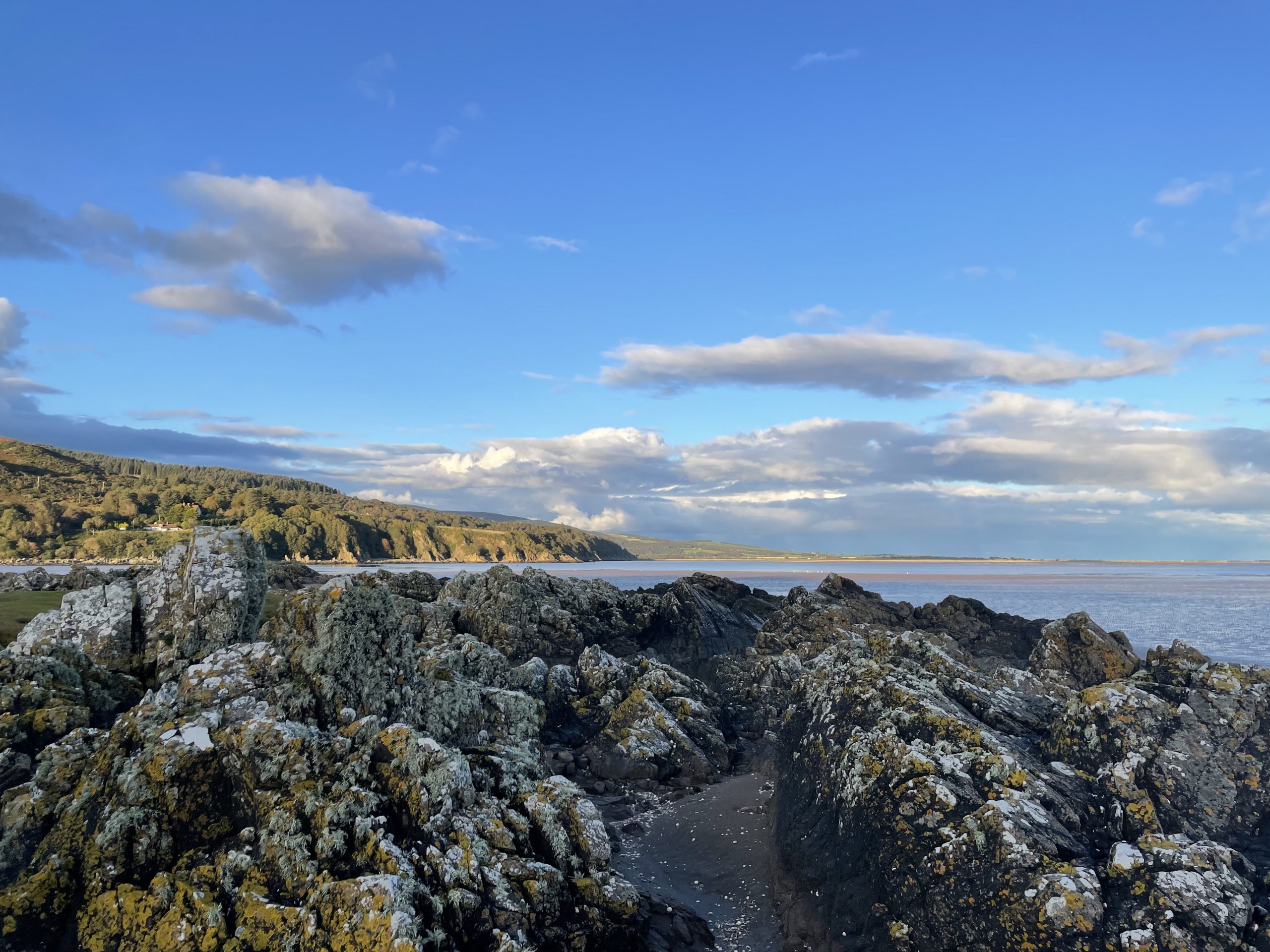
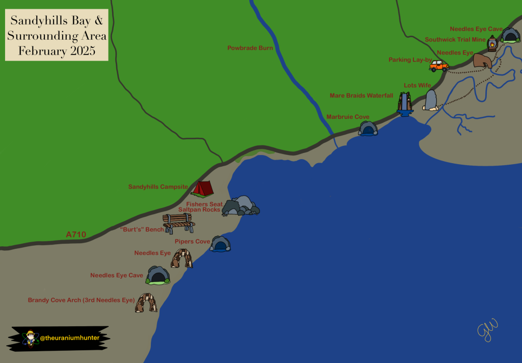
The Southwick Coast, stretching from Portling Bay to Needle’s Eye, is a breathtaking stretch of Scotland’s coastline. Known for its dramatic cliffs, golden beaches, and unique geological features like Brandy Cove, Piper’s Cove, Sandyhills Bay, Marbruie Cove, and the iconic Lot’s Wife, this area is a treasure trove for nature lovers and scientists alike. It’s also home to the Mersehead Nature Reserve, a Site of Special Scientific Interest (SSSI) teeming with wildlife.
But there’s more to this coastline than meets the eye. Hidden within its cliffs are radioactive veins rich in uranium, making it one of the most fascinating – and least explored – radioactive hotspots in the UK.
Radioactivity Along the Cliffs
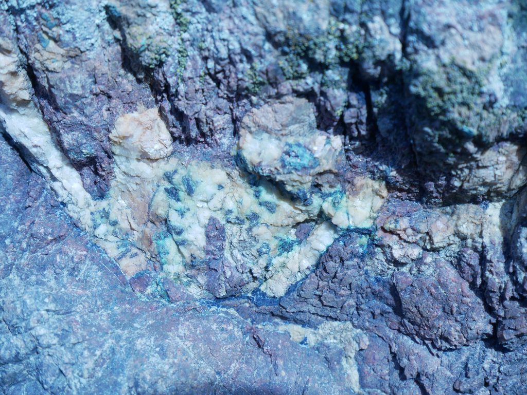
The Southwick Coast is unique for its radioactive veins, which are embedded within the cliffs and contain uranium minerals. These veins are scattered across the coastline, with some areas showing particularly high levels of radioactivity.
The geology of the area is a complex mix of Silurian metasedimentary rocks, which have been thermally altered (or hornfelsed) in places, and the Criffel granodiorite, a large igneous intrusion. There are also Carboniferous rocks present, adding to the geological diversity.
The Origin of the Radioactive Veins
The story of the Southwick Coast’s radioactivity begins over 400 million years ago, during the Silurian period, when sedimentary rocks were first laid down. Later, during the late Silurian to early Devonian, a massive granitic intrusion – the Criffel pluton – pushed its way into the Earth’s crust.
This event caused thermal metamorphism, transforming the surrounding Silurian sediments into hornfels. As the rocks cooled, mineral-rich fluids flowed through faults and fractures, depositing minerals like uraninite (a primary uranium-bearing mineral) along with copper, bismuth, cobalt, and nickel.
Varied Concentrations of Radioactivity
Not all parts of the coast are equally radioactive. Some areas, like the cliffs near Powbrade Burn and Marbruie Cove, are densely packed with radioactive veins, while others show only weak traces of radioactivity. The veins themselves vary in width and composition, with uraninite concentrated in specific locations.
This patchy distribution makes the Southwick Coast a fascinating area for exploration, as each section of the cliffs tells a slightly different story of geological processes and mineral formation.
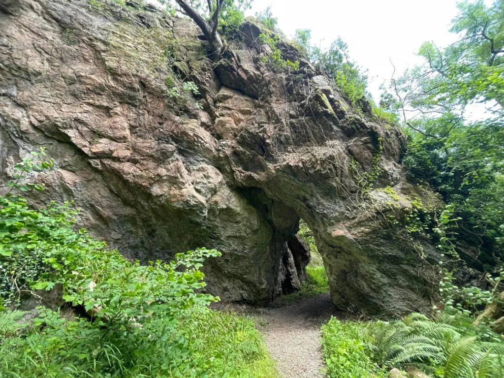
Needle’s Eye: A Natural Laboratory
One of the most intriguing spots along the coast is the Needle’s Eye, a natural rock arch that acts as a natural laboratory for studying radioactive elements. Here, scientists have observed how uranium-rich groundwater flows from the cliffs and interacts with the organic-rich soil of the Merse (the local floodplain).
This soil, rich in organic matter, effectively traps uranium, preventing it from flowing into nearby Southwick Water. This natural process provides valuable insights into how radioactive elements behave in the environment – knowledge that’s crucial for understanding long-term nuclear waste disposal.
What’s Next?
In future blog posts, we’ll take a deeper dive into the Needle’s Eye, exploring its geology, history, and the secrets it holds. For now, if you’re eager to see the Southwick Coast in action, check out The Uranium Hunter YouTube channel, where we document our field trips to this radioactive wonderland.