This post accompanies our latest YouTube video: “Uranium Hunting in a Military Zone: The Forbidden Radioactive Hotspot.”
The “Three U’s” and the Haslam Challenge
In 2025, I took on Dr. Haslam’s “Three U’s” challenge. In his Geochemical survey of stream waters and stream sediments from the Cheviot area, he named three locations with uranium mineralisation: Linhope Spout, Bleakhope, and Bellyside. We visited all three and found radioactive signals at each.
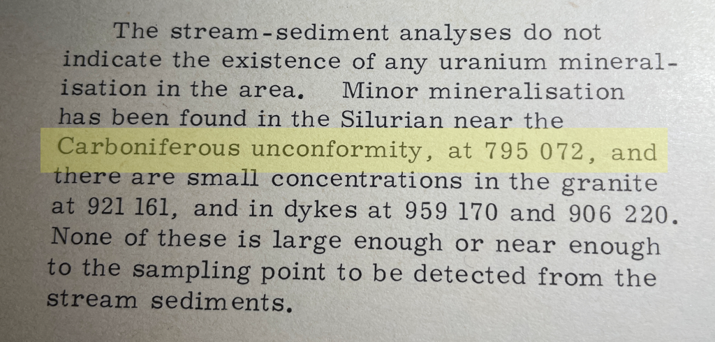
But the same paragraph contained a bonus site. Harden Edge [NT 795 072] was listed as a fourth, minor copper-uranium (Cu-U) occurrence so localised it didn’t even show up in general stream sediment surveys. For a uranium hunter, that’s the ultimate test of field skills. I had to go.
One Grid Reference, Three Rocks
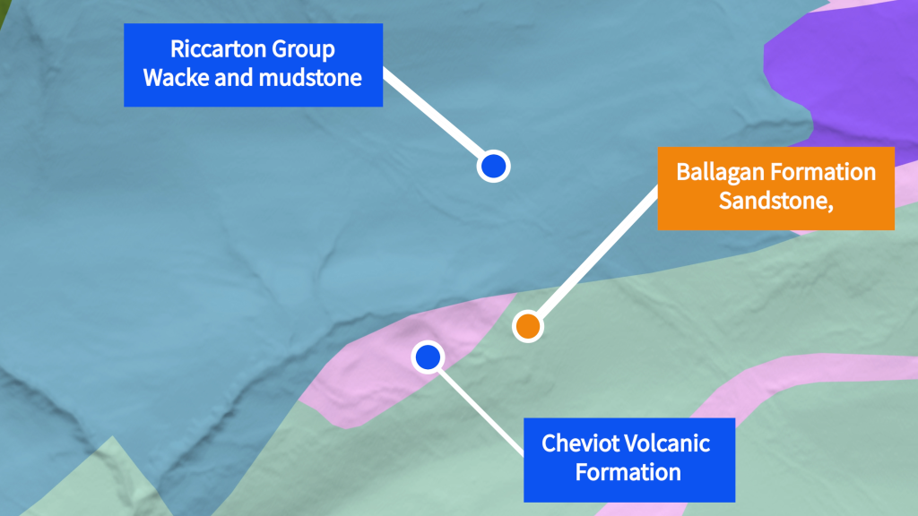
The basement: Silurian Riccarton Group
First came the Silurian greywackes and mudstones, laid down at the bottom of the Iapetus Ocean – an ancient sea that separated Scotland and Northern Ireland from the rest of Britain. These rocks are chemically reducing, making them a perfect sponge for uranium.
The orogeny: folding and missing time
The Caledonian Orogeny deformed this Silurian basement. As the Iapetus Ocean closed and the continents of Laurentia and Avalonia collided, flat ocean-floor layers were caught in a tectonic vice, creating the steeply dipping, tightly folded structures we saw in the “Rainbow Rock” at Canker Cleugh. The Cheviot Volcano then erupted onto this mangled basement – its andesite and tuff still nearby. At Harden Edge, these volcanic rocks rest unconformably on the Silurian, marking a massive gap in the geological record.
The lid: Carboniferous Ballagan Formation
The Carboniferous brought ancient briny seas and swampy deltas. Sand, mud, plants, and marine life laid down the youngest rocks here: the Ballagan Formation, a cyclic sequence of sandy mudstones, limestones, and sandstones. The basal conglomerate contains boulders of andesite and granite, proving the giant Cheviot volcano had largely eroded away before the Carboniferous seas arrived.
The Hunt
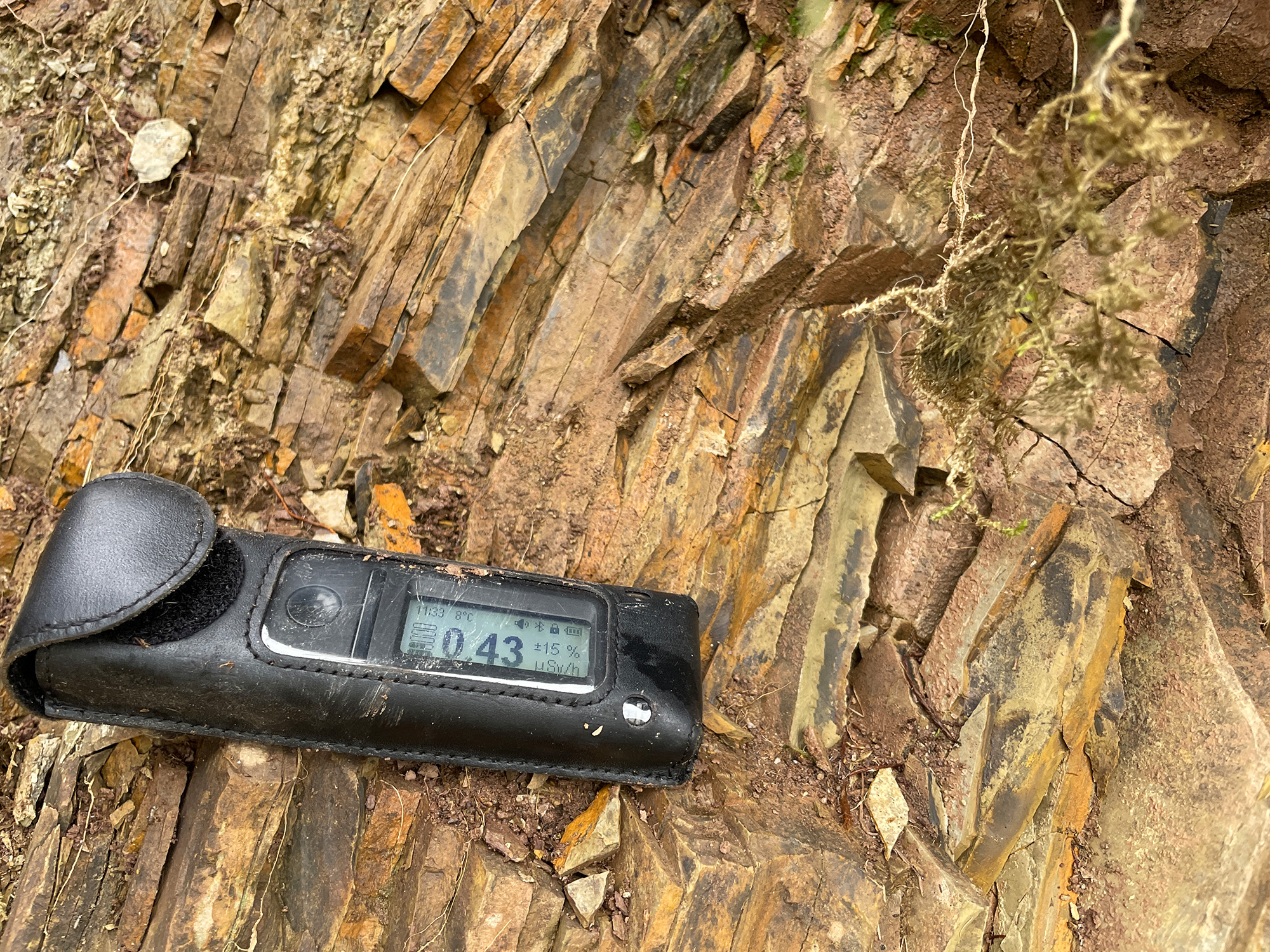
We found a small signal (~1 μSv) at the unconformity, plus a wide range of coloured rocks – hinting at iron, copper, manganese, and other minerals. The largest signal (3 μSv) came from a joint between the Silurian and limestone, where a fan of vein material was visible. Neither spot revealed an obvious uranium-bearing mineral; the readings were generalised to the area.
Probing the Canker Cleugh Rainbow
Field exploration began at NT 795 072, where the valley of Canker Cleugh dips steeply, exposing the southern Cheviots’ structural foundations. The target was the contact between the Silurian Riccarton Group and the Carboniferous Ballagan Formation.
Area 1: The “Rainbow Rock” Unconformity
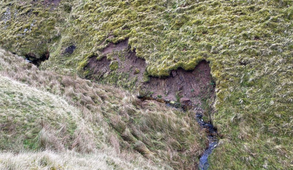
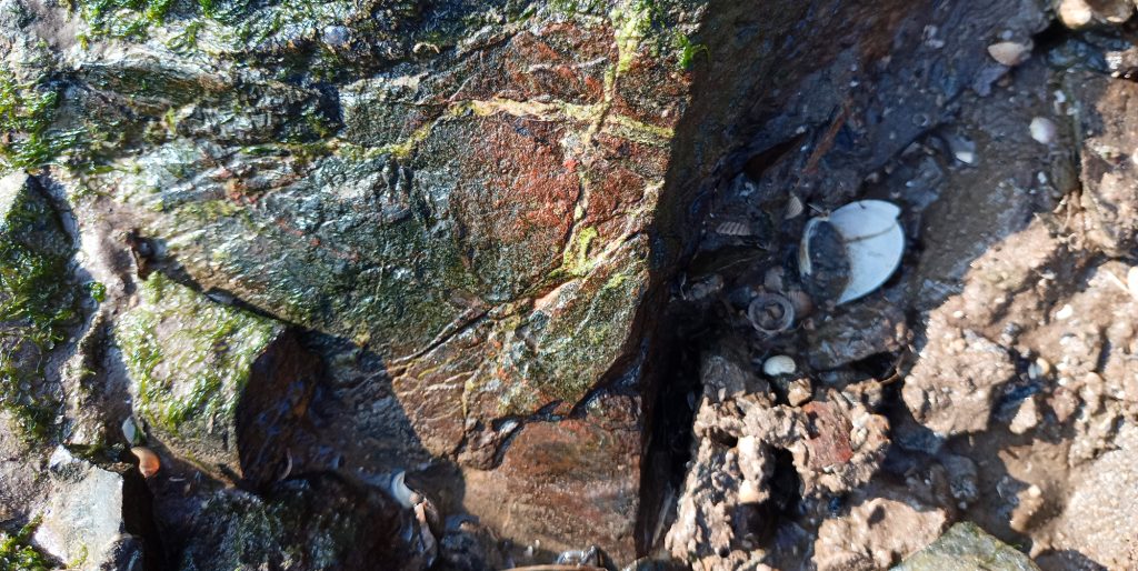
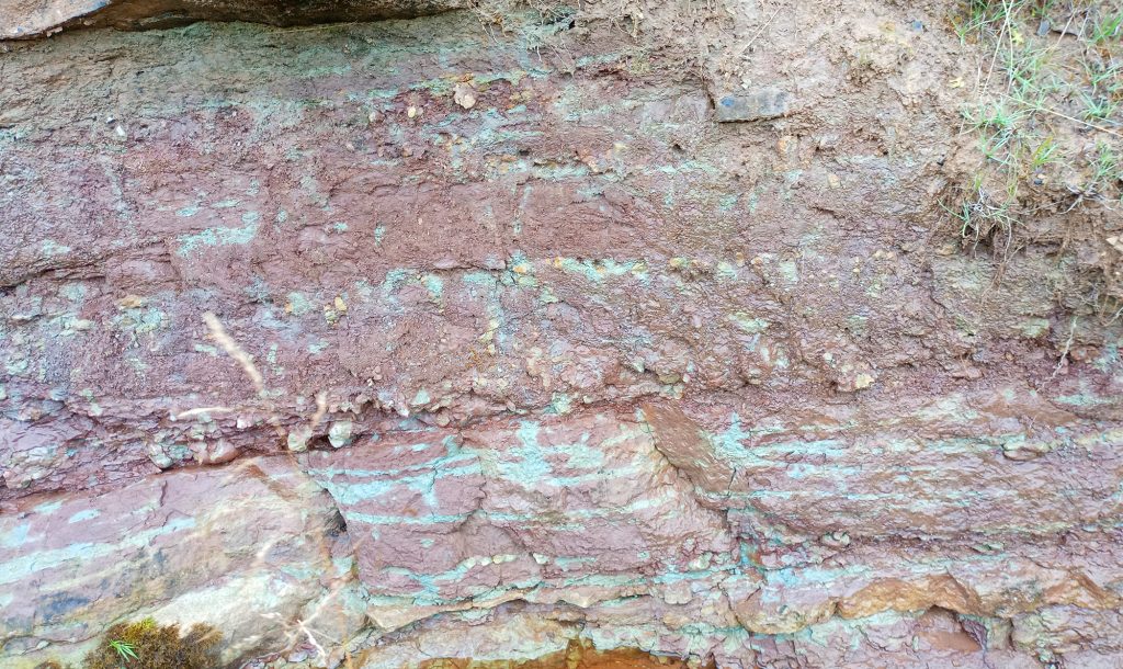
On the south bank of the river, a striking angular unconformity displayed vibrant oranges, browns, and purples – visual “smoke” for mineralising fluids, potentially iron, copper, and manganese. Scanning revealed a localised radiometric signal of ~1 μSv at the unconformity’s downward bend. A 10 cm excavation showed no change in lithology or visible mineralisation, suggesting the radioactivity is in the rock fabric itself, not a single vein.
Area 2: The 3 μSv “Fan”
Ten metres further, at the river’s horseshoe end, a joint between the steeply dipping Silurian basement and the overlying Carboniferous limestone featured a fan of vein material – brown, “baked,” with distinct black flecks. This yielded the hunt’s highest reading: 3 μSv. Dr. Haslam recorded up to 600 μR/hr (roughly 6 μSv/hr) in mineralised siltstones.
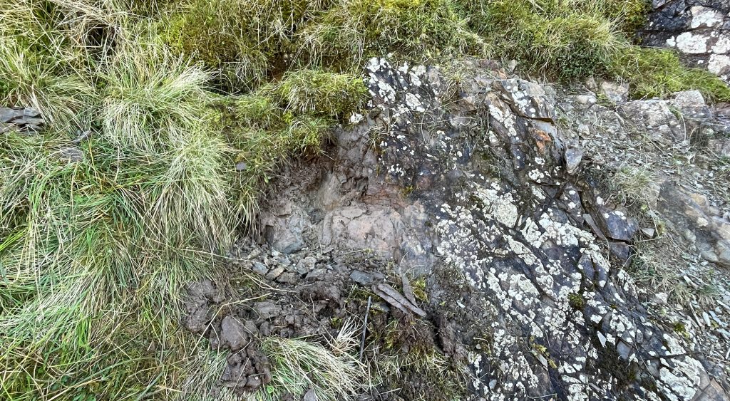
The Visual Paradox
These readings are much higher than those from the “Three U’s.” Why? Rock types. The granites at the Cheviot Pluton’s edges are hard, impermeable, and solid – any uranium occurs in thin veins. Here, the Riccarton Group sand and mudstones are porous and, crucially, reducing. Denied oxygen, uranium converts into an insoluble form and remains trapped in the Silurian “sponge.” That explains both the higher readings and the lack of visible mineralisation.
Dr. Haslam agrees. In his earlier paper The Distribution of the Radioactive Elements in the Rocks of the Cheviot Area, he noted Canker Cleugh as his highest reading in the Cheviots. Our 3 μSv correlates with his 600 μR/hr (~6 μSv/hr) at NT 795 072.
Dating the Uranium: U-Pb Geochronology
We don’t yet know the uranium’s age, only that it’s younger than the host rocks (Silurian, ~430 million years old). But we can date it using U-Pb dating, exploiting its very radioactivity.
Uranium decays at a known, constant rate into stable lead isotopes. By measuring the ratio of parent uranium (²³⁸U and ²³⁵U) to daughter lead (²⁰⁶Pb and ²⁰⁷Pb) inside a mineral, geologists calculate exactly when that mineral crystallised from a fluid – the moment the “clock” was set.
We’ve done this before. At Needle’s Eye on the Southwick Coast, pitchblende from the Steps Vein yielded a U-Pb age of 185 ± 20 million years – over 200 million years after the host Criffel Granite (410 Ma). That means the granite’s structure acted as a permanent “plumbing system,” reactivated by later tectonic events in the Triassic or Jurassic.
How the Uranium Got Here: The Heat Engine
Uranium and other metals need hot hydrothermal fluids to transport them from deep within the continental crust. The main rock-building ended ~350 Ma, so what supplied the heat?
- Radiogenic heat from the granite itself – The Cheviot Granite is a High Heat Producing (HHP) “hot rock,” enriched in uranium, thorium, and potassium. Constant radioactive decay creates a permanent geothermal anomaly, keeping the pluton warmer than the surrounding crust for hundreds of millions of years.
- The Hercynian “re-heater” (~301 Ma) – The Whin Sill event injected massive volumes of molten quartz-dolerite into the Northumberland Trough. This heat pulse triggered fluid circulation that formed lead and barium veins in the North Pennines, likely flushing the Breamish Fault corridor and remobilising uranium into secondary traps. The Kelso Traps (north) are another candidate from this epoch.
- The Jurassic Pulse (~185 Ma analogue) – As seen at Needle’s Eye, uranium in British granites often dates to the Jurassic. No major Jurassic lavas exist in the Cheviots, but tectonic transtension during the Atlantic’s initial opening reactivated deep faults (Breamish, Harthope), allowing warm, metal-rich fluids to rise without a visible local volcano.
- The Tertiary Fire (~60 Ma) – The Acklington Dyke cuts through the southern Cheviots as a finger of the Iceland Mantle Plume. Around 60 million years ago, Atlantic opening drove intense magmatism across northwest Britain. This very late, high-intensity heat engine could have driven the final “polishing” of the uranium signal, moving mobile U(VI) ions one last time into the shallow Silurian siltstones.
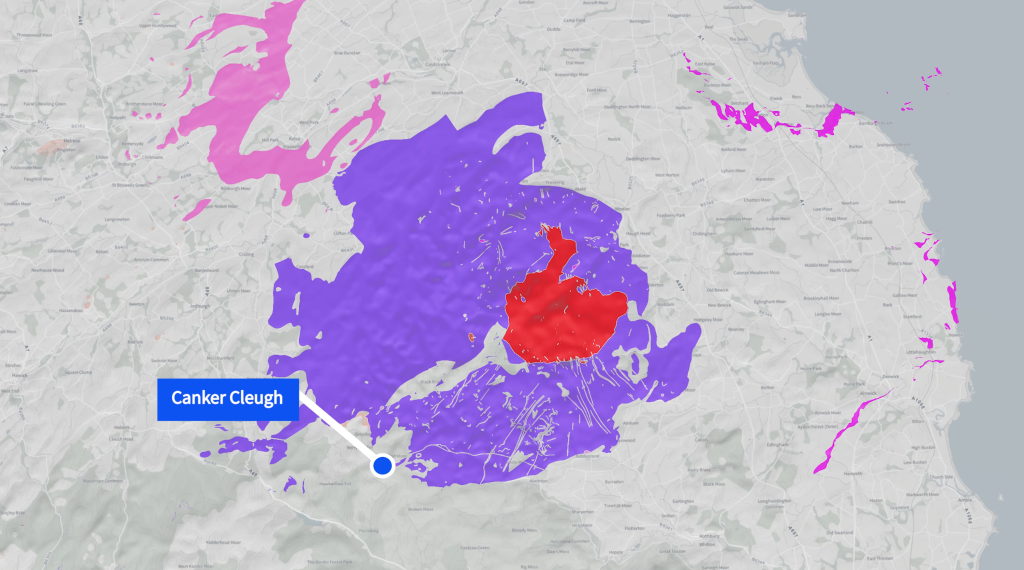
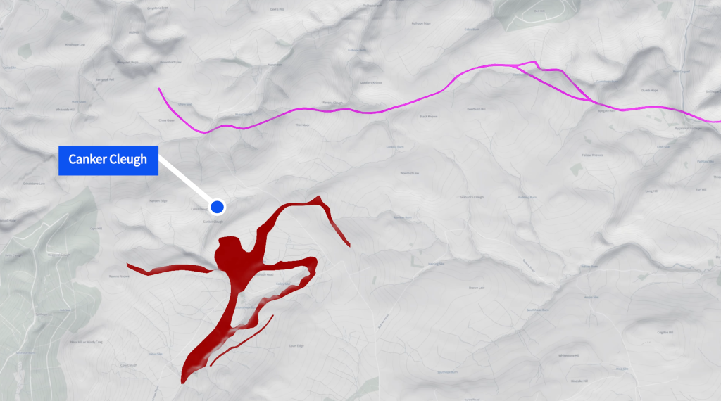
4 possible “heat engines”: image 1 – Kelso Traps, Whin Sill. image 2 – Cottonshop Lavas, Acklington Dyke.
The “Ghost” in the Plumbing
The uranium at Canker Cleugh is likely polyphase. Originally locked in the granite’s magmatic “bones” 400 million years ago, it was liberated and moved by successive heat engines – the Cottonshope Lavas, the Whin Sill, and finally the Acklington Dyke – using the region’s fault network as a permanent highway through time.
Ideas for Future Exploration
Cross Cleugh Staining [NT 793 070]
On a previous visit, I spotted green, blue, and purple staining near the junction with Cross Cleugh. The green and blue are almost certainly malachite and azurite (copper carbonates), formed by oxidation of primary chalcopyrite. Purple-to-deep-red staining in the Cheviots often points to haematite or secondary manganese oxides like romanechite, recorded in panned concentrates from similar “spongy” zones. This site sits exactly between the Cu-U occurrence at NT 795 072 and Clough’s 1888 vein at NT 792 068, supporting a fault-controlled mineralised corridor along the river’s southern bank.
NT 792 068 and further downstream
Charlie Clough’s original 1888 mineralisation zone remains unexamined. While not identified as uranium-bearing by Dr. Haslam, it’s too good a target to ignore. The entire river down to Cottonshope offers a promising opportunity – the Riccarton Silurian “sponge” may provide a more concentrated pathway for uranium than the hard rocks of the Cheviots.
A geniuine appeal
I would love to visit this again with someone with greater prospecting or geology knowledge than I have. I’m very much at the beginning of my journey. If anyone is interested please email tuh@theuraniumhunter.co.uk or drop me a line via any of my socials.