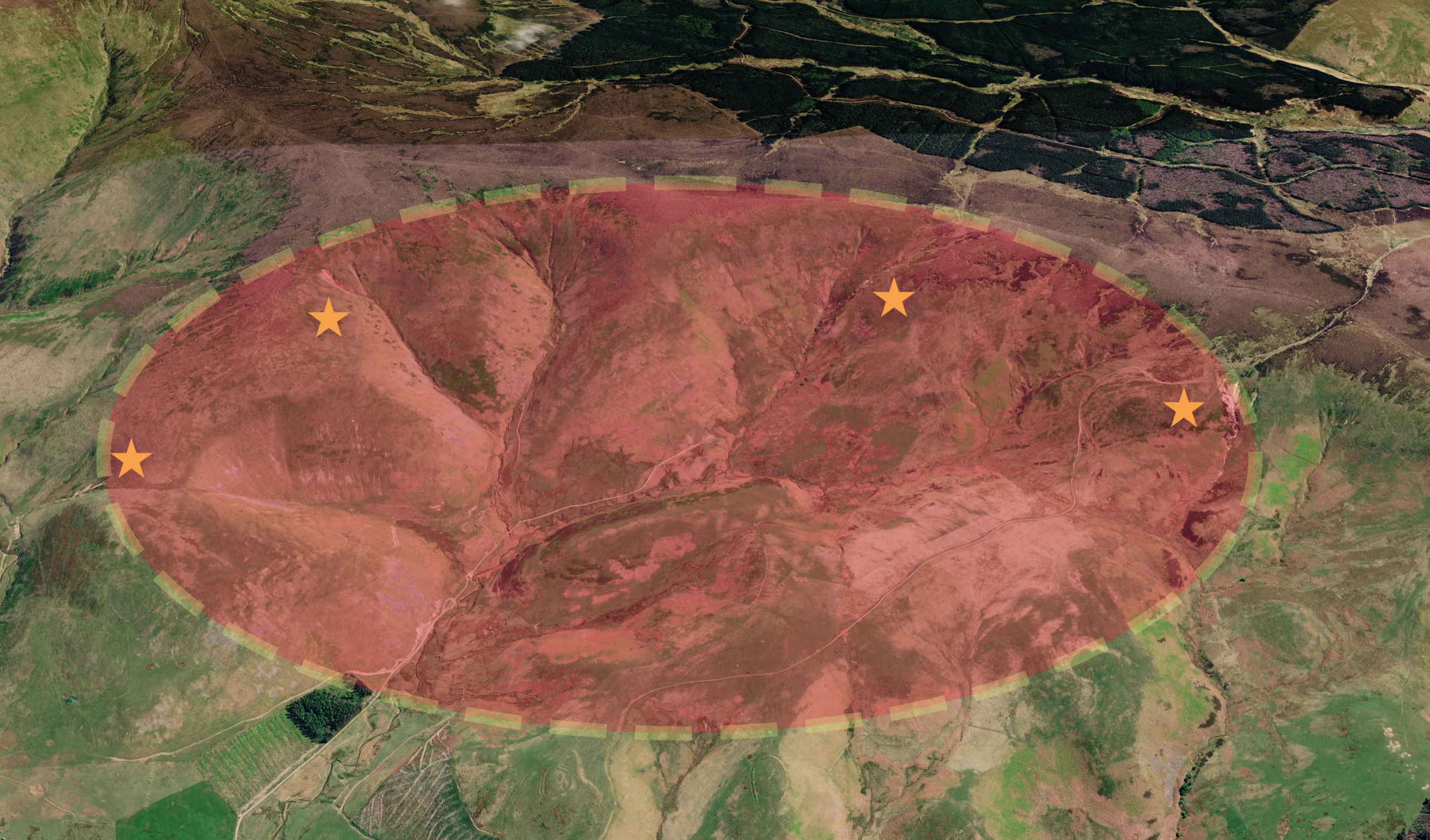
This blog post accompanies the 2-part video “The Missing gold of the Cheviots” now available on YouTube. Over three visits, we explored the area of Kingsseat Burn in the Scottish Cheviots. We didn’t cover all of the science in the video; this blog post offers a deep dive into the geology and mineralogy of the Kingsseat Burn area.
Geological Background
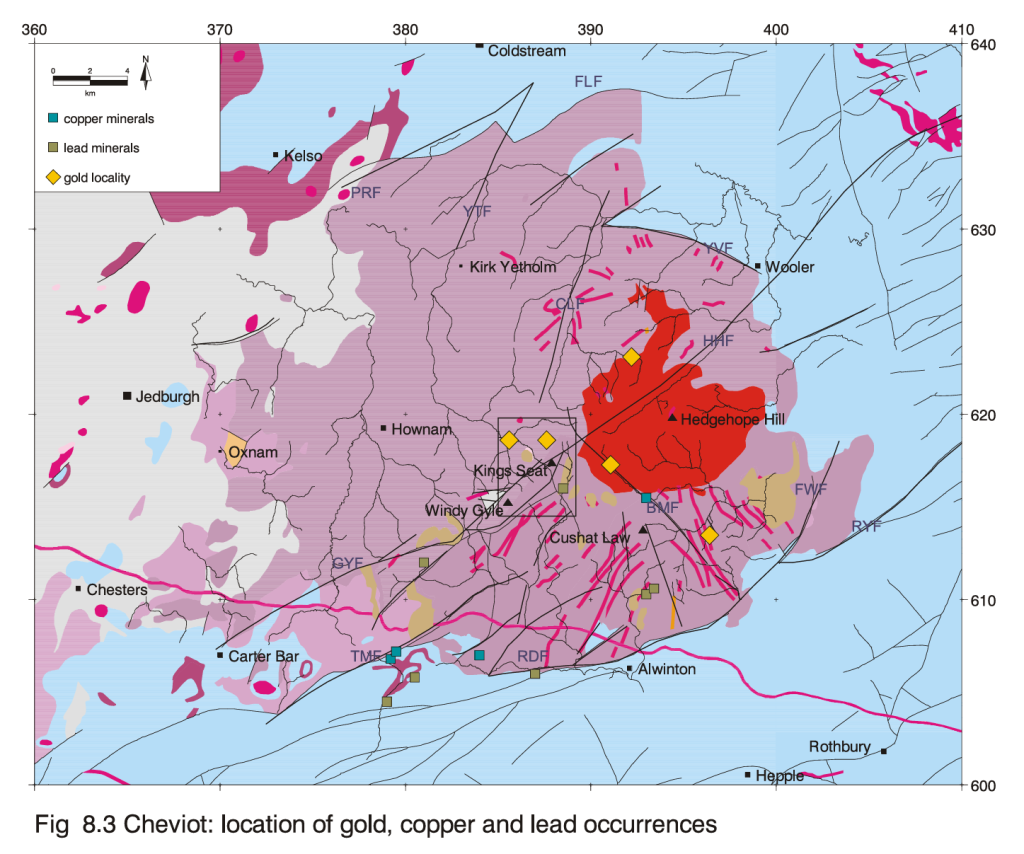
Kingsseat Burn sits in the North-West Cheviots. Lying just inside the Scottish border, it is a key part of the Cock Law Complex. The geology – at least so we thought – is the same as most of the outer Cheviots: andesites, tuff and rhyolite. These rocks formed around 400 million years ago from the Lower Devonian Cheviot Volcanic Group, when the area was dominated by volcanism resulting from the Caledonian Orogeny; a mountain-building event caused by the collision and subsequent pulling apart (transtension) of two ancient continents.
An intrusion of magma – called the Cheviot Pluton – intruded underneath the volcanic rock, both providing uplift and a heat source for hydrothermal and mineralisation events. Subsequent erosion removed three-quarters of the original volcano, exposing the pluton, with an approximate 50 sq km area of granite now exposed at the heart of the Cheviots.
The Kingsseat Metal Madness
In the 1970s, as part of the UK Government’s MRP (Mineral Reconnaissance Programme), Dr. Hugh Haslam and colleagues surveyed the wider Cheviot area. They took water and sediment samples to map out the mineralogy of the Cheviots. They found exceptionally high levels of metals such as copper, zinc, antimony, beryllium and molybdenum around Kingsseat. This geochemical outlier also included silver and uranium – of course. The zone extended 15 km² round Kingsseat Burn and was far richer than any other Cheviot area.
The Cock-Law Complex, the Older Brother
No explanation was given why until 1988, when a follow-up study confirmed the results of the previous analysis. By visiting over 700 sample points, they gathered enough data to explain the origins of such high readings. Crucially, they added panned concentrates to their sampling arsenal.
Amongst the results, the presence of kaolinite confirmed that the Cock Law Complex had its own laccolith (underground, shallow, mushroom-shaped) magma intrusion, independent of the Cheviot Pluton
Dating around 5 to 10 million years prior, in combination with the Gyle-Harthope fault (GHF), the complex’s intrusion provided the heat engine and pathways for 5 different phases (polyphase) of mineralisation. This is where the metals came from.
As it was first, there is inference that the Cock Law Complex via the GHF ‘stole’ the majority of metals available from the magma, before its younger brother had formed.

The Man with the Golden Gunn
A follow-up study in 2000 by Dr. Gus Gunn and Keith Rollin used a “knowledge-based prospectivity mapping system” called XMAP to forensically examine the area.
Combining data science, geological analogues and re-analysed the 1988 samples. They used gravimetric and magnetic survey data to confirm the presence of the Cock Law Complex: its giant granitic body under the Kingsseat Burn area.
However, Gus Gunn’s expertise was in epithermal gold deposits. The geology of the Cock Law complex was similar to other occurrences in Scotland such as Borland Glen and Lagalochan. These areas – the same age as the Cheviots – proved the area was capable of hosting gold deposits.
By combining data from those Scottish studies with evidence from the Kingsseat Research, Dr. Gunn concluded that the Kingsseat Burn area had the hallmarks of a high-grade epithermal system
The Powerhouse Sample – NTR 54
When re-analyising rock samples from previous expeditions, Dr. Gunn found one sample – named NTR 54 – had the most extreme levels in one single sample. The metals – ranging from Silver (Ag), Arsenic (As), Antimony (Sb), Copper (Cu), Barium (Ba), Iron (Fe), Manganese (Mn), Molybdenum (Mo), Tungsten (W), Lead (Pb), and Uranium (U) – were much higher than in any other samples. It also contained 43 ppb of gold, again the highest.
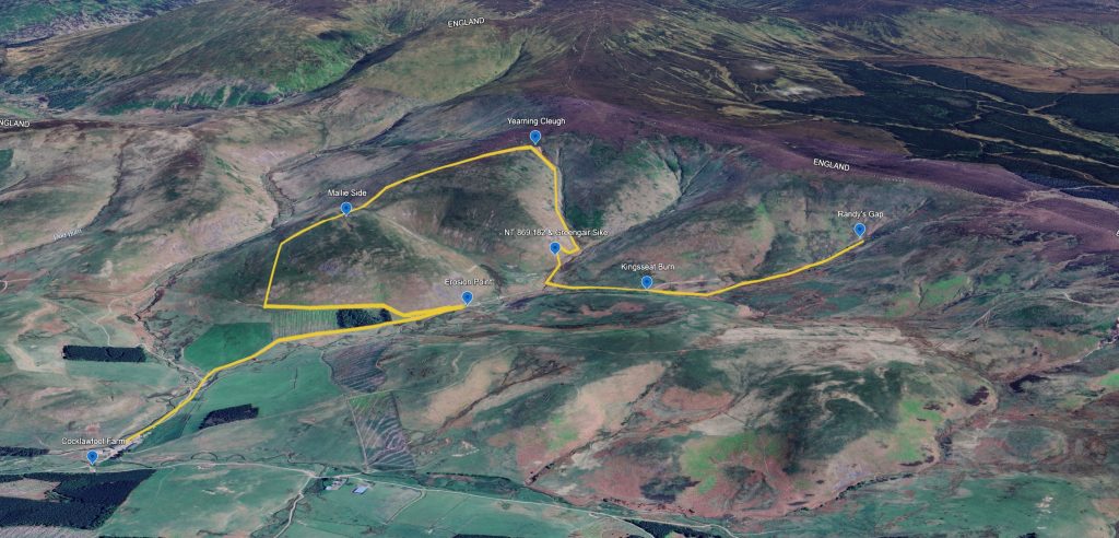
The sample was found 20m from the head of Yearning Cleugh; it and similar rocks in the area confirmed that the top of Yearning Cleugh was complete with many metres of worn gossan and altered rocks. This in turn, pointed to the area being an example of the “roof” of an epithermal system – known as an Advanced Argillic Alteration Zone.
NTR 54 turned out to be an outlier on our field trips. We could only find one rock of a similar nature – haematite altered with a stockwork of carbonate veins – and that was downstream in the wash-out. While we worried it might be a lone erratic, the BGS reports confirm NTR 54 is part of the actual bedrock – an outcropping gossan that proves the ‘cargo’ is anchored right here at the head of the Cleugh.

We were reminded that 90% of the rocks here are hidden under peat, till and soil. So naturally, there may only be one or two of these ‘powerhouse’ rocks accessible. We had to go beyond the papers and look for ourselves.
Going Beyond the Papers – our Fieldwork
On our 3 field trips, we extended the work of Drs Haslam and Gunn, both confirming some aspects, and making our own observations.
High U, High Erosion
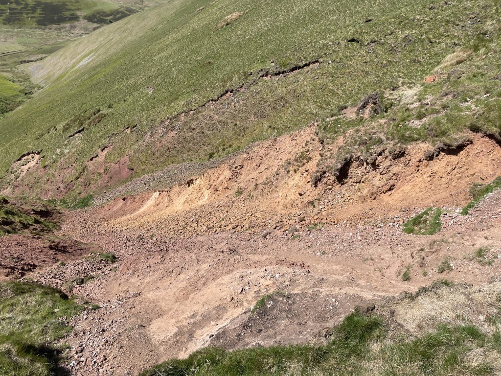
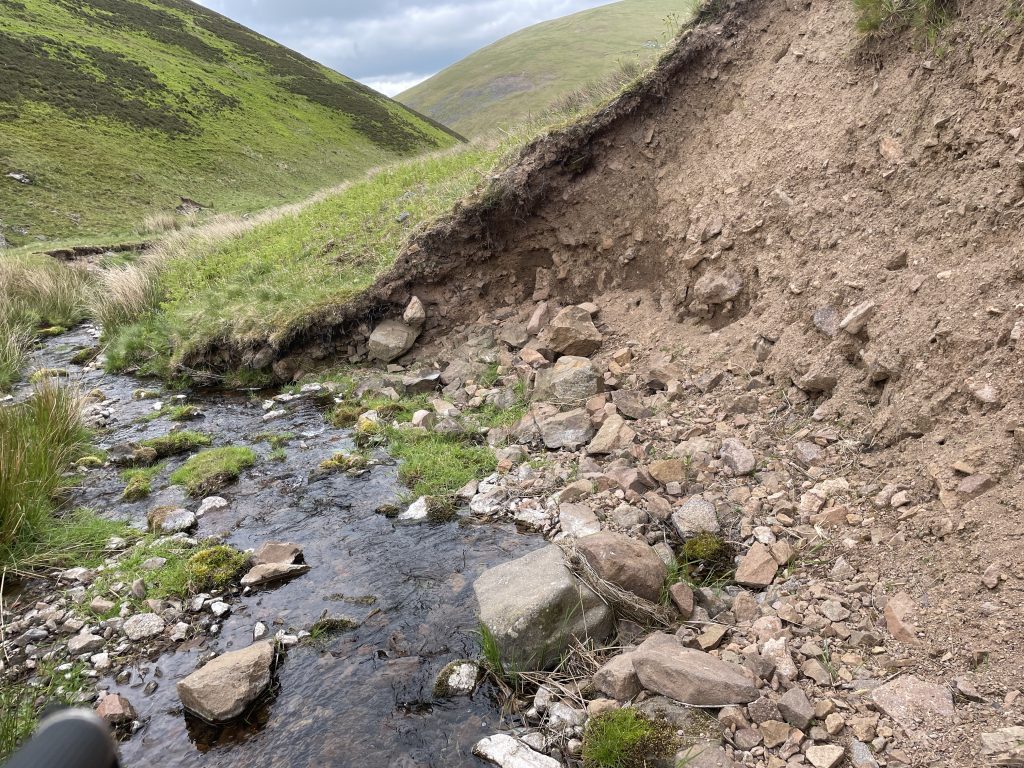
When observing an eroded rock face parallel to Kingsseat Burn we observed two things:
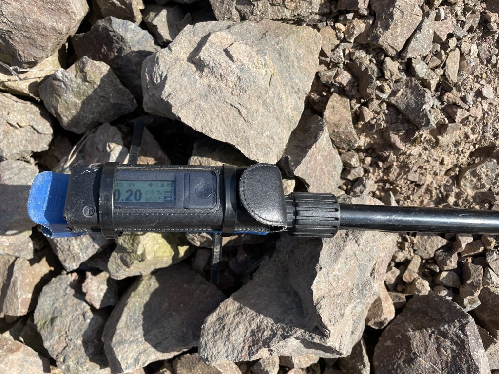
Firstly, the rock – a mix of andesite and tuff – had elements of mineralisation, mainly iron staining. Its readings on the Radiacode were 0.2 μSv – high in comparison to other Cheviot rocks we’d observed.
Secondly, there was an erosion event right in front of our eyes, a portion of the face ran down the bank. We got to see erosion – a key factor in the geology of this area – in real time.
This confirmed two things: the rocks here were indeed higher in metals than elsewhere in the Cheviots, and erosion plays a big part in shaping the area, even today.
NT 869 182
Dr. Haslam mentioned this grid reference as being a mineral occurrence – high in baryte and malachite. Whilst the area on initial observation was a grassy hill, we found in the exposed soil areas a wide variety of mineral samples such as baryte, calcite and quartz. We found nothing in Greengair Syke, the closest stream to the grid reference. However, the 1988 report found panned concentrates here had 7% Barium – that’s a lot of metal.
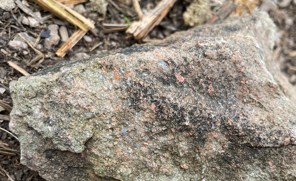
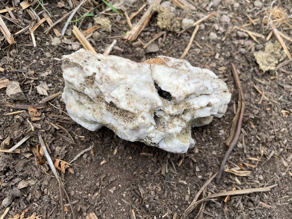
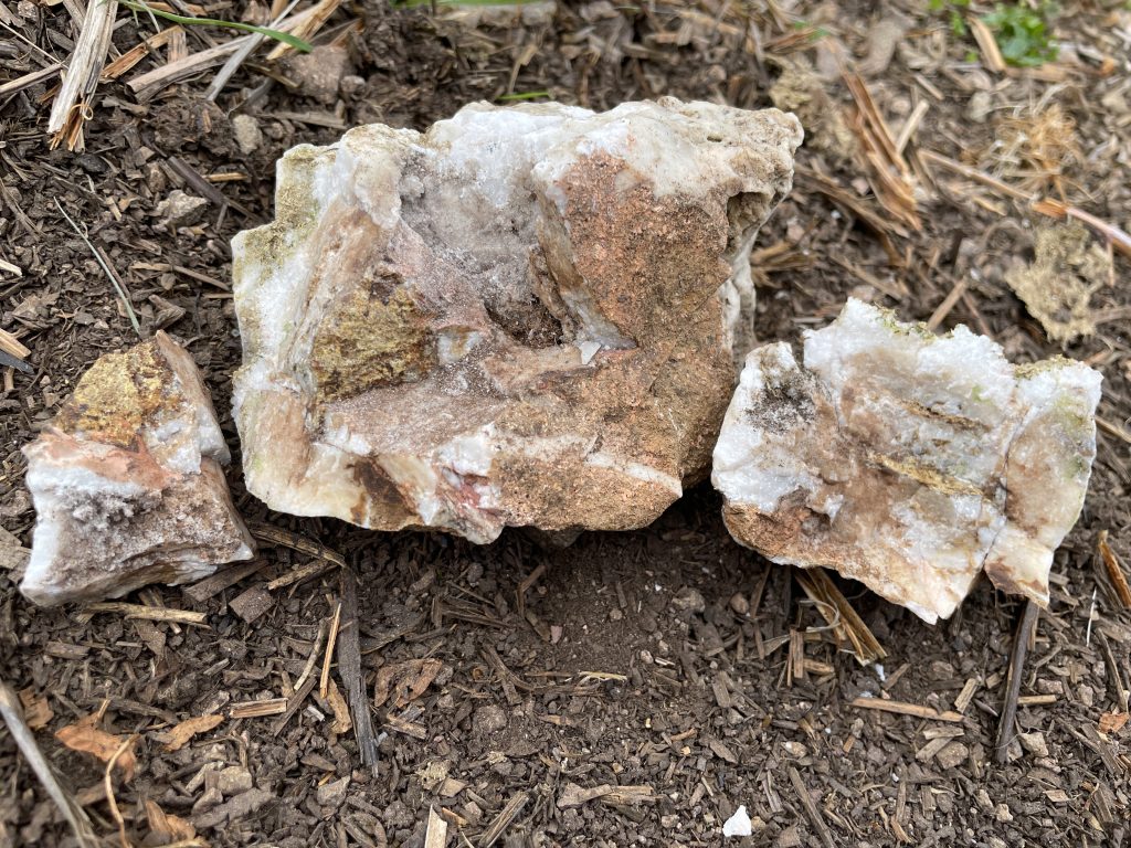
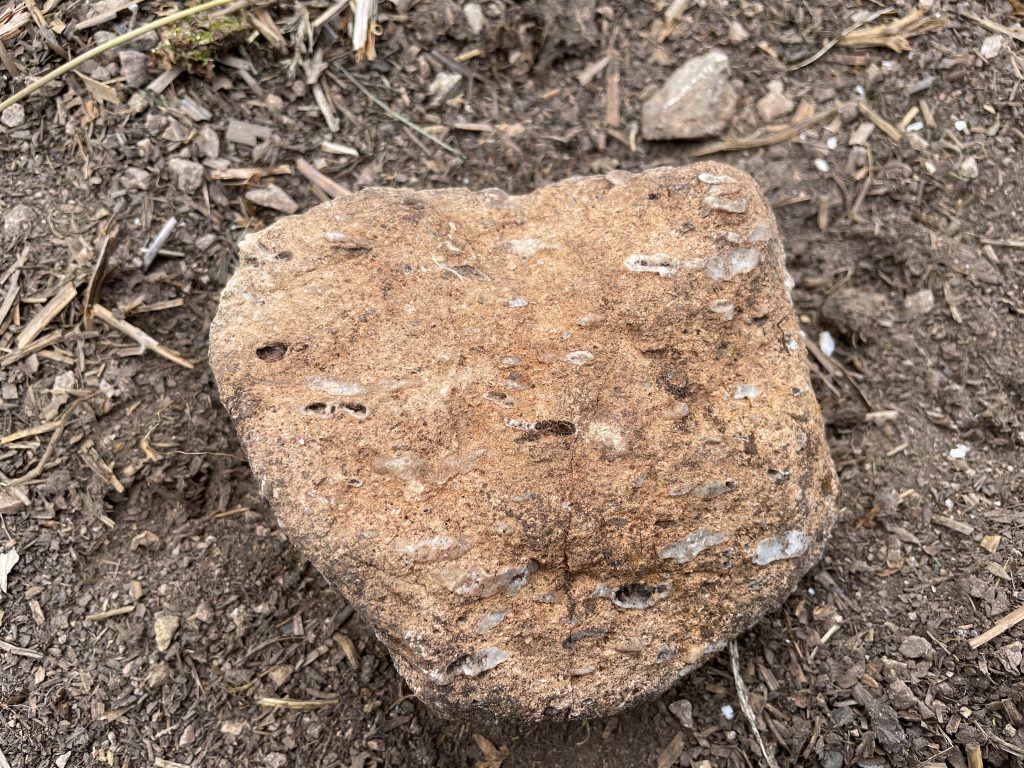
This was an important observation as it both confirmed the “metal madness” of the Kingsseat Burn area, and this location provides the starting point of a mineralisation zone stretching south-east across the Cheviots to Allerhope [NT 920 100]. Interestingly, the GHF isn’t far from here.
Randy’s Gap and the Repeat
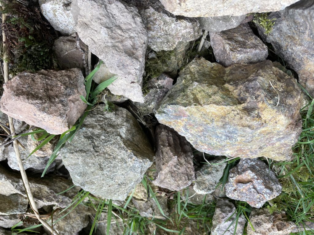
Towards the foot of Randy’s Gap – a tributary of Kingsseat Burn – we found a biotite porphyry intrusion of rock highlighted by kaolinite, the mineral used as a pathfinder by the 1988 survey to prove the existence of the Cock Law Complex. We also found, in the stream, similar rock fragments to Yearning Cleugh, thus indicating that the “worn, gossan top” of the epithermal system may stretch much wider than just one stream head.
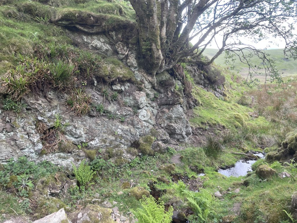
A re-reading of the photographic maps shows several other worn areas at the heads of streams in the Cock Law area (e.g. Randy’s Gap, Greengair Syke, and Inner Brye Cleugh); teasing an epithermal system that may have stretched many square kilometers.
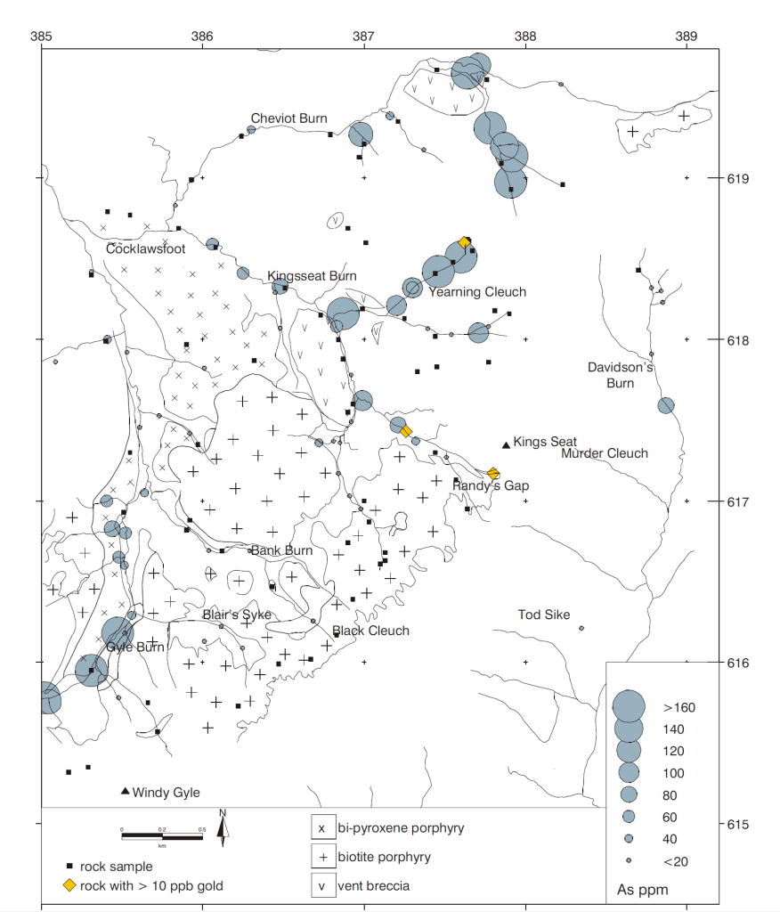
As a footnote, gold was also found in the 2000 study, in smaller quantities than NTR 54, at Randy’s Gap.
The possibility of gold deposits
The 2000 Dr. Gunn paper suggested that any gold deposits may have been eroded away, and used similar sites in Scotland i.e. Lagalochan as analogues. However, our field research uncovered many pointers that may provide a hope for any potential gold exploration.
- The head of Yearning Cleugh is the roof of a system; it has survived 1-2km of weathering of the tops of the Cheviots
- The “Precious Metal Interval” is at or even under the tops of the hills here
- The epithermal system is not just isolated to Yearning Cleugh
- Yearning Cleugh’s stream only shows half-way down the gorge, suggesting it follows pathways underground, inside the hills
- Vuggs – we found many examples of vuggy rocks in the Kingsseat Burn area, a classic “gold pathfinder” trait of high-sulphidation epithermal systems
- There is an arsenic “halo” surrounding the area – over 9 km2
But, most important of all, was the occurrence of quartz.
The Smoking Gun: Botryoidal Quartz and the Boiling Zone
We found two samples of botryoidal quartz with manganese mineral staining. This type of mineral is the literal pipework of the epithermal system. Not only do we still have the roof of the system as evidenced by Yearning Cleugh, the ‘plumbing’ is also still present. It is being eroded in near real-time – those samples were found in the streams at Yearning Cleugh and its parent, Greengair Syke.
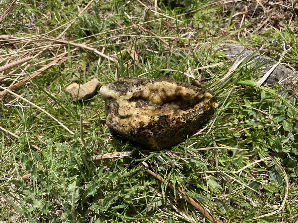
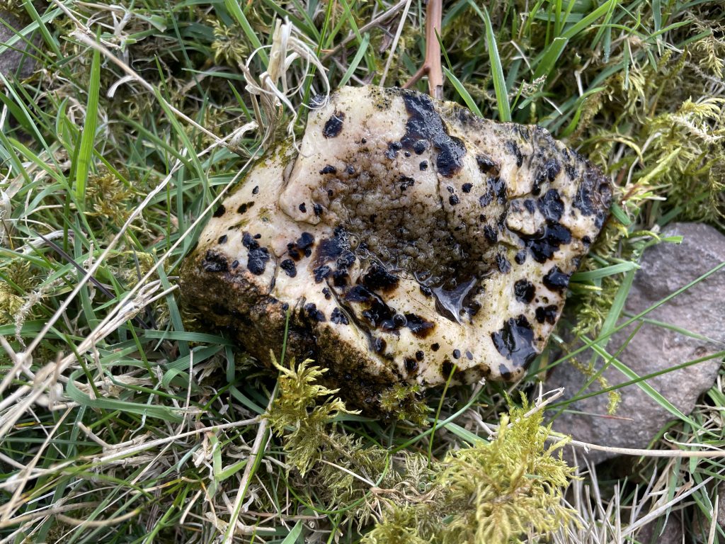
The nature of the quartz is also important too – the ‘bubbles’ of this type of quartz indicates the presence of a boiling zone, the exact point where hot, pressurised hydrothermals dump (or precipitate out) their high grade gold and silver deposits.
We also found no quartz at all the head of Yearning Cleugh, it was all gossan and altered andesite, carbonate veining. The sudden occurrence of quartz from half-way down to the floor of the Kingsseat Burn valley again supports a theory that yes – some of the epithermal system has eroded (the missing quartz), but much remains.
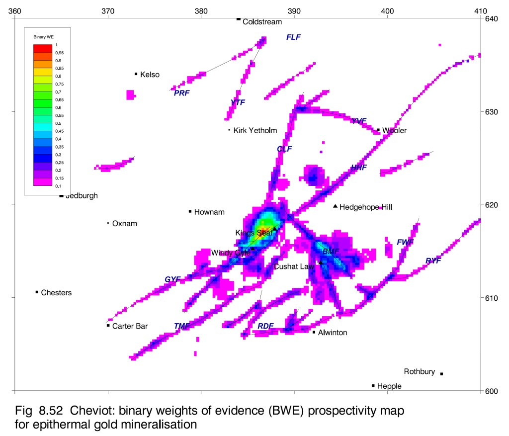
Dr. Gunn went one step further, his paper’s final page was a map based on his own model. He took every data point, every reading, every mention and provided a map of where he thought it most likely to find gold in the Cheviots. Target #1 – the Kingsseat-Windy Gyle area.
The Negatives and I’m not a Gold Hunter
True, my interest in Kingsseat Burn was from my channel’s primary mission: to find naturally occurring radioactive minerals. Yes, the general background readings were above par, but prior research on Kingsseat Burn did not suggest we’d find discrete uranium or thorium mineralisation. Save for NTR 54, the powerhouse of the area.
As we didn’t find an analogue to NTR 54, apart from one stream sample, our Radiacode didn’t do much. We became far more intrigued with the history of gold in the area, and whether it was historical at all.
There are many reasons, apart from my inexperience, about why there may not be any gold deposits present, even deep underground, except in microscopic amounts.
I summarise them as:
- 43 ppb – the ‘wow’ rock had 43 parts per billion of gold. That’s nothing. Commercial gold miners need parts per million to be interested; the research suggested that was actually a high number for an expired deposit, so it may not be a negative.
- Manganese “Blocker” – Manganese isn’t always a “slam dunk”; sometimes it acts as a negative in epithermal systems.
- Gold Panning – finding stockwork veins doesn’t mean they contain – or contained – gold. I know of no notable gold panning activity both in the area and further out towards the North Sea i.e. Bowmont Water. The only panning spots I know of are much further West.
- Sulphide Gap: finding evidence of sulphide erosion (the vuggs, gossan) may be a double-edged sword. The gold may have gone with the acidic fluids along with the sulphur millions of years ago
Cononish and a “lack of looking”
A few weeks ago I went to Tyndrum. It’s famous for two metals: lead and gold. They used to mine for lead but now they actively mine for gold. The gold at Cononish was found using models and modern methods that initially detected levels starting at 1-2 ppb; far lower than NTR 54. Gone was the gold pan.
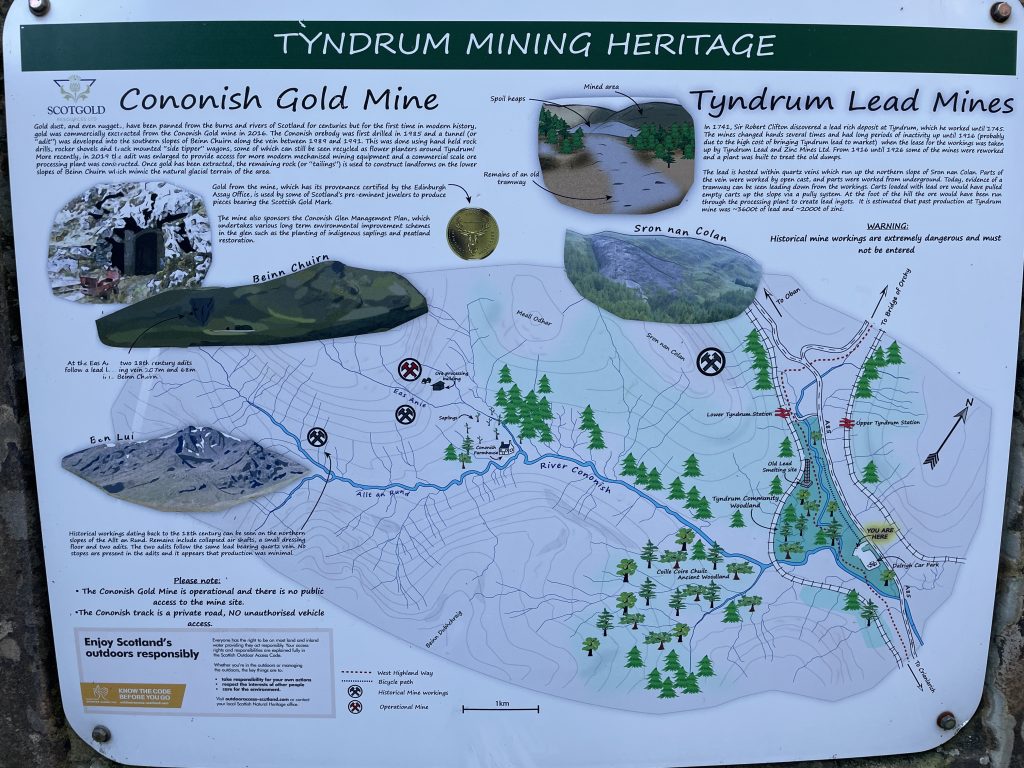
We can positively compare Kingsseat to Cononish:
| Feature | Cononish | Kingsseat Burn |
| Gold Style | Microscopic / Fine-grained (<20 µm) | Low-tenor / “Invisible” in bedrock |
| Main Gangue | Quartz & Calcite | Quartz & Carbonate (Calcite) |
| Late Phase | Baryte | “Late baryte veins” |
| Host Alteration | “Reddened” (Hematite/Pyrite) | Haematitisation / “Sea of Red” |
| Economic Sign | Active gold mine with >160,000 ounces of mineable gold | Sample NTR 54 (highest regional gold) + 3 other >10ppb samples |
More importantly, we proved all of that on our field trip: we found the quartz, carbonate/calcite, and baryte, and couldn’t move for red. The main difference is the host rock: Cononish is metamorphic, Kingsseat is volcanic.
“Lack of Looking” is a valid – the most obvious – conclusion. We haven’t found gold at Kinggseat Burn (or confirmed there are minimal amounts) simply because we haven’t looked. The 2000 study only reanalysed data, nothing new was pulled from the ground. I checked with the BGS and they confirm no-one has been since. So how do we address that?
Drill, baby, drill
The area – apart from Cocklawfoot Farm – has few roads, so wide-scale exploration will be difficult and costly. Just a few miles away are Windy Gyle, the Border Ridge and The Cheviot – isolated, protected areas which quite rightly are only accessible by foot.
So how can we confirm the status of the epithermal deposits? With rock exposures infrequent, drilling – taking core samples – is the most obvious suggestion. However, there are other, less intrusive methods such as:
- More geochemical samples – simply taking more samples and using modern techniques will give us a better picture of the area’s geochemistry. Panned concentrates would be the most revealing, literally copying what our gold panning friends do. With modern methods, analytical detection limits of 1–2 ppb (parts per billion) are achievable.
- Modern surveying techniques – Magnetic Surveys, Induced Polarization (IP) and VLF-EM – modern methods to take an “X-Ray” of the landscape.
- Follow the Quartz – map the occurrences of quartz and their type – in very simplistic terms, where the botryoidal quartz stops, is the most likely place for epithermal stockwork veins and the “boiling zone”.
- Crowdsourcing – speak to local farmers, land users, gold panners and explorers to see if anyone has found anything of interest in the area.
As for the original mission?
The Uranium Hunter isn’t completely out of the game. In fact, sometimes not finding something is just as revealing as getting the prize. There is Uranium here, but is there Uranium mineralisation? Uranium mineralisation in the Cock Law Complex was most likely a late-phase event. Like at Canker Cleugh, this could have been anywhere between 300-60 million years ago, concentrating the metals like Uranium in the rocks.
Frustratingly, all the signs are there – high-temperature hydrothermals, reducing ‘peaty’ soil and heat-engine of the Cock Law intrusion. As well as three papers full of data suggesting there should be the U. Here’s possibilities for a follow-up.
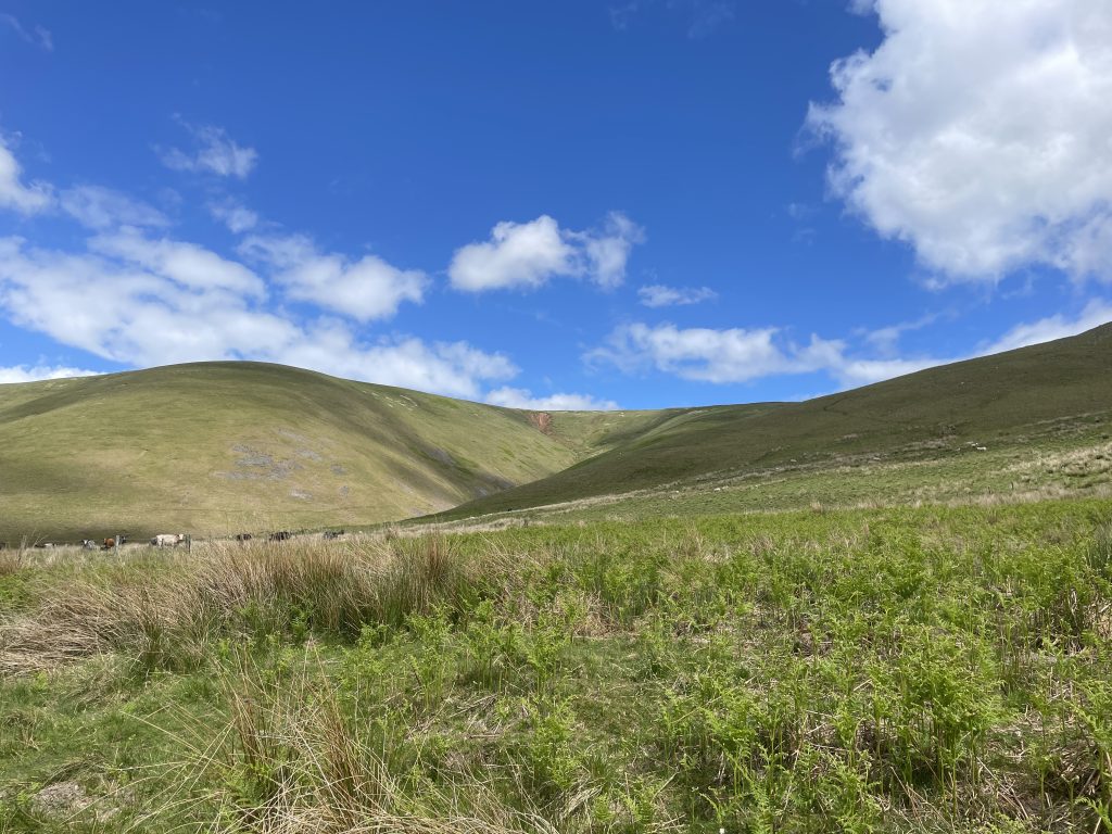
The fact that there is so much erosion – we saw it for ourselves – can be a help. Instead of climbing up or down the 78% slope scree of Yearning Cleugh – a foolhardy expedition without equipment – I could let Mother Nature do the work. A careful study of rock fragments in the streams of Kingsseat Burn and its tributaries may unveil another rock as mighty as NTR 54. Each stream acts as a conveyor belt.
Panning – no not for gold, but for ‘heavies’. Just like the researchers back in 1988, an amateur like me can do the same, and pan sediments with a classifier and a simple gold pan. Streams often have areas which act as natural mineral traps. Heavies – dense, metalliferous sediment – if found can both point to radioactive mineralisation, and in themselves be radioactive. A simple magnet can remove the iron. A spoiler for a future video – I did just this at Linhope Burn.
The Manganese Trap – botryoidal quartz with dark crusts is just as likely to host Uranium as it is Manganese.
3D maps show there are many potential “roofs” with less dramatic gradients. May a visit to the heads of Randy’s Gap, Inner Brye Cleugh or Outer Cock Law be more fruitful?
For now, my walking boots and rock-hammer will be going to other places. Do you have any experience of the minerals in this area? Are you a gold panner who keeps their secrets to themselves? Drop me a message, I’d be curious to see what you know.
References:
Leake, R. C. and Haslam, H. W. 1978. A geochemical survey of the Cheviot area in Northumberland and Roxburghshire using panned mineral concentrates. Rep. Inst. Geol. Sci., No. 78/4
Cameron, D. G., Cooper, D. C., Bide, P. J., Allen, P. M., and Haslam, H. W. 1988. A geochemical survey of part of the Cheviot Hills and investigations of drainage anomalies in the Kingsseat area. Mineral Reconnaissance Programme Report, British Geological Survey, No. 91
Gunn, A. G. and Rollin, K. E. 2000. Exploration methods and new targets for epithermal gold mineralisation in the Devonian rocks of northern Britain. BGS Research Report, RR/00/08